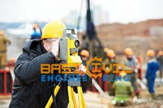
Top 30 Questions and Answers for Interviews About Surveying

Top 30 Questions and Answers for Interviews About Surveying
Are you getting ready for a job interview as a land surveyor in civil engineering? You’ve taken a step toward a career that will be rewarding. We have compiled a list of the top 105 survey questions & answers to the help you do well in the following interview. This excellent resource covers a wide range of the topics, from basic ideas to the advanced techniques, so you’ll be ready to the confidently answer any question your interviewer throws at you. So, get ready to show your potential employer how knowledgeable and skilled you are in surveying, and start a successful career in this interesting field.
What is the Surveying in Civil Engineering?
In civil engineering, surveying entails calculating and charting various terrain features’ locations, sizes, slopes, and elevations. It is an essential component of civil engineering projects, offering vital information for designing, planning, and building numerous infrastructure pieces, including buildings, bridges, roads, and pipelines.
Engineers can more accurately set out building projects when measuring a site, establishing boundaries, and understanding its circumstances. Surveyors gather information using a variety of methods and tools, allowing civil engineers to make educated judgments and guarantee that projects are done precisely and effectively.
Concerned about your civil engineering career path? Take our Civil Engineering Career Choice Test to determine which way is best for you based on your interests and abilities and to begin your path to a rewarding career in the field.
Top 100 Interview Questions and Answers on Surveying Subjects in Civil Engineering
It might be difficult to the prepare for an interview in the subject of the surveying because there are so many things to take into account. We have gathered a list of the surveyor questions and responses covering a wide range of topics to assist you in succeeding.
This includes building surveying interview questions that probe the complexities of evaluating buildings and their condition, civil engineering surveying interview questions that concentrate on the connection between surveying and civil engineering projects, and total station survey interview questions that delve into the technical facets of using total stations for precise measurements.
The Our list also includes general surveyor questions and answers that cover a wide range of the topics in the industry, land surveyor interview questions that address the legal, ethical, and technical aspects of the land surveying, and digital survey interview questions to assist you in understanding the most recent technologies used in the industry.
You will be equipped and self-assured to handle any interview situation in the surveying field by mastering these questions. Here are the top 105 interview questions and answers on civil engineering surveying topics;
i ). Can you define surveying?
By the measuring angles, distances, and elevations, surveying is the process of the figuring out the relative positions of the places on or near the surface of the Earth. Construction, transportation, and mapping are just a few of its civil engineering uses.
ii ). What are the different types of surveying?
There are several types of the surveying, including:
- Land Surveying
- Construction Surveying
- Topographic Surveying
- Hydrographic Surveying
- Mining Surveying
iii ). What are the instruments used in surveying?
Several instruments are used in the surveying, including:
- Total Station
- Theodolite
- GPS receiver
- Level
- Measuring tape
- Prism pole
iv ). What are the advantages of using a Total Station in surveying?
Total Station is an electronic instrument used in the surveying. Some of the advantages of the using a Total Station are:
- High precision and accuracy
- Faster and more efficient than traditional surveying methods
- Can measure both angles and distances
- Can store data for future use
v ). What is GPS in surveying?
Surveying uses GPS, (Global Positioning System), a satellite-based navigation system. It employs GPS satellite signals to pinpoint a point’s exact location on the surface of the Earth.
vi ). How do you calculate the area of a plot using surveying techniques?
The following processes are commonly taken to determine a plot’s area using surveying techniques:
- Use a measuring tape or total station to determine the plot’s perimeter.
- the layout into more compact triangles or rectangles.
- Measure each triangle or rectangle’s length and width.
- Use the area formula to determine the area of each triangle or rectangle.
- To determine the total area of the plot, add the areas of all the triangles or rectangles.
vii ). What is a benchmark in surveying?
In surveying, a benchmark is a constant, stable site with a known height. Other elevation measurements in the region utilize it as a reference point.
viii ). How do you find the elevation of a point using surveying techniques?
- Place a level close to the measurement location.
- Determine the height of a benchmark close to the point.
- Calculate the level’s height above the benchmark.
- Calculate the point’s elevation by deducting the level’s height from the benchmark’s elevation.
ix ). What is the purpose of contour lines in surveying?
The lines that connect locations on a map with the same height are known as contour lines in surveying. The position of features like hills, valleys, and ridges can be found using them to describe the form and slope of the ground.
x ). What are the different types of errors in surveying?
There are several types of the errors in surveying, including:
- Systematic errors: Mistakes that are repeatable and fixable.
- Random errors: Unavoidable errors that happen at random.
- Errors: Mistakes can result from human error or equipment failure.
- Gross mistakes: Mistakes resulting from inaccurate data entry or measurement.
11. What is the difference between a plane survey and a geodetic survey?
A plane survey is carried out over a limited area with little curvature to the Earth’s surface. A geodetic survey is that covers a wide region and takes into the consideration the curvature of the Earth’s surface.
12. What is the purpose of a traverse in surveying?
In surveying, a traverse is a collection of linked lines used to measure the positions of points on the surface of the Earth. A thorough map of the area being surveyed is made using it.
Read More:
-
What is the Bricks & Important Tests on Brick
-
Technology for the locating underground utilities
-
Types of the Roads or Classification of Roads
13. How do you calculate the length of a line using surveying techniques?
Following these procedures is customary when determining a line’s length using surveying techniques:
- Calculate the angle between the line’s two endpoints using a theodolite or total station.
- Using a measuring tape or total station, determine the separation between the line’s two endpoints.
- By using the measured angle and distance along with trigonometry, determine the line length.
14. What is a topographic map?
A topographic map is a map that depicts how the surface of the Earth is shaped and elevated. When creating a detailed map of a region, it uses contour lines to the indicate locations of equal elevation
15. What is the purpose of a level in surveying?
Surveyors use levels to compare the relative height of various sites on the surface of the Earth. A thorough map of the area being surveyed is made using it.
16. What is a vertical angle in surveying?
In surveying, a vertical angle is an angle between a horizontal line and an upward- or downward-facing line of sight. It is employed to calculate a point’s elevation on the surface of the Earth.
17. What is the purpose of a prism pole in surveying?
In surveying, a prism pole supports a prism or reflector that bounces light back toward a total station. It is employed to calculate angles and distances.
18. What is a horizontal angle in surveying?
The angle between two lines on a horizontal plane is a horizontal angle in surveying. It is employed to establish the direction of travel between two points
19. What is the purpose of a plumb bob in surveying?
A plumb bob is used to ascertain a point’s vertical alignment in surveying. A point must be directly above or below another point for it to be used.
20. What is a traverse station in surveying?
In surveying, a traverse station is a location where measurements are made. It is employed to establish the locations of points on the surface of the Earth.
21. What is the purpose of a survey control network?
A survey control network is a system of anchor points used to determine the location and elevation of places on the surface of the Earth. It helps to guarantee the precision of survey measurements.
22. What is a benchmark in surveying?
In surveying, a benchmark is a constant, stable site with a known height. Other elevation measurements in the region utilize it as a reference point.
23. What is a reference line in surveying?
In surveying, a reference line is a line that serves as a benchmark for measurements. It helps to guarantee the precision of survey measurements.
24. What is the purpose of a stadia rod in surveying?
A stadia rod is used in surveying to measure elevation and distance. It contains a graduated scale that the surveyor can use to measure the separation between the instrument and the rod and the difference in elevation between the two. The surveyor reads the distance and elevation measurements while holding the stadia rod vertically and using the instrument’s telescope. The stadia rod is a crucial instrument for surveyors because it enables quick and precise measurements of distances and heights.
25. What is a plumb line in surveying?
In surveying, a plumb line is a vertical line that is used to establish how a point or construction should be aligned. It serves to guarantee the verticality of the point or building.
26. What is the difference between a spot elevation and a contour line in surveying?
In surveying, a spot elevation is a point on a map that accurately depicts a specific site’s height. In surveying, a contour line joins points on a map with the same height.
27. What is a horizontal control network in surveying?
In surveying, a horizontal control network is a system of reference points used to determine the horizontal positions of points on the surface of the Earth. It helps to guarantee the precision of survey measurements.
28. What is a vertical control network in surveying?
In surveying, a vertical control network is a system of reference points used to determine the vertical positions of points on the surface of the Earth. It helps to guarantee the precision of survey measurements.
29. What is a traverse in surveying?
In surveying, a traverse is a collection of linked lines used to measure the positions of points on the surface of the Earth. A thorough map of the area being surveyed is made using
30. What is the purpose of a magnetic compass in surveying?
In surveying, magnetic north is located with a magnetic compass. It serves as a guide for measuring things and figuring out how to position structures.


