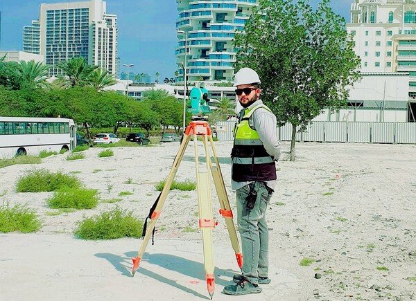
Responsibilities of a Land Surveyor

Responsibilities of a Land Surveyor
The Land Surveyor’s job is to take accurate measurements showing where the boundary is. Surveyors help Engineers make maps and build projects by giving them information about the unique shapes of the earth’s surface.
The following are the Duties of the Land Surveyor.
- The Surveyors must measure the distance and angles between certain points on the surface of the earth.
- By traveling, you can find certain important feature points based on reference points.
- Records about the land, its survey, and its titles are studied in detail.
- Find the boundary lines by looking for the old boundary lines that are still on the site.
- The surveys are taken, and the results are written down. Later, they are checked for correctness and changes.
- Reports of the surveyed sites are made based on the plots and maps of the surveyed records.
- The results of the surveys are given to the clients and the relevant government agencies.
- The official land boundaries and water needs are set. These are set up either to rent out or to sell.

Land surveyors use special tools to measure and evaluate the sites of private, public, and government property. Land surveyors make land survey reports and calculate measurements and evaluations.
Work Characteristics of the Land Surveyor
There are three different parts to the surveyor’s work. These are:
- Field Work
- Office Work
- Instruments Care and Adjustments
Field Work Conducted by Surveyors
As the surveyor’s job description says, he has to measure the distances and angles between the points and write them down as field notes.
The operations involved in the field works are:
- The first step was to set up benchmarks and use all stations as a guide. The horizontal and vertical control is set up based on these operations.
- It is important to measure the angles between the survey lines.
- The stations and the lines between them explain and locate all the survey details. The details are the streams, buildings, landmarks, streets, and other natural or artificial features in the area surveyed.
- Surveyors must set out the lines and grades for construction projects like buildings, culverts, sewers, bridges, and water supply systems.
- A surveyor does a survey to determine how high or low specific points are. Or in either case, certain issues must be set up at the correct heights.
- We are surveying the land’s topography. This is the process of figuring out the shape of a piece of land using vertical and horizontal controls.
- There must be parallel lines and lines that go in the opposite direction.
- The points that can’t be reached have to be measured.
- To do surveys despite the problems. There are a lot of different trigonometric and geometric fieldworks that need to be done.
- The meridian, latitude, and longitude, or the local time, can be found by making observations of the sun or a star.
- When doing fieldwork, it is essential to know what Field Notes are and what they are used for.
- Field notes are written notes made while the research is being done in the field. Sometimes, the accuracy of the survey and the work done in the area doesn’t matter if the value recorded needs to be corrected.
- Because of this, a surveyor’s field record shows more about the quality and skill of his work than the basic surveying tasks he did.
The field notes must be valid, complete, and brief. The values and comments must be written in clear, simple letters and numbers. When making a field note, you should follow a few simple rules. These are:
- The values are written down in the field book after the observations.
- The 2H or 3H pencil must be sharp. Never use a soft pencil or one with ink.
- It’s best to write in a straightforward way that stays the same.
- Try to use as many sketches as you can.
- A short note must be written at the end of each survey work day. This must have the work’s name, the survey’s date, the weather conditions, a list of the instruments used, and a list of the people who worked on it.
- It is best not to wipe out. If you make a mistake, rule through it and write the correct value above it.
- The people who make the daily notes must sign them.
The filed note consists of the three parts:
1. Numerical Values
This column on the field book is where all the measurements, like length, angles, staff readings, and offsets, are written down. All the actual numbers must be written down correctly. The closest values to 0.01 must be written down. If the value is 342.30, it should be written as the same, not 343.3.
2. Sketches
The sketches will look like the edges, the shapes of the land, and where things are about each other. They need to be made to the correct size. If we want to put the measurements on the sketches, we must mark them correctly. Always make a sketch that makes it easy to understand. This must be clear as possible. The sketches need to be big, open, and clear.
3. Explanatory Notes
Everything that can’t be said through the values and remarks must be written in the “Explanatory Note” section. These comments will help with the rest of the work.
Read More
-
Differents Types of Beams in Construction
-
Construction projects using concrete: Materials, Types, and Applications
-
TYPES OF BUILDING FOUNDATIONS, SELECTION CRITERIA, AND BASIC REQUIREMENTS
-
How to plan the budget for home renovation
Office Works Done By surveyor
The surveyor has to do work in the office, like drawing, doing math, and making plans.
Plans and sections are made as part of the drafting work. These must be measured and drawn to scale so that the topographic maps can be made.
The process of computing is done in two ways. At first, it can be done to plan the plot. Second, it can be built to calculate the areas and volumes.
Instruments Care and Adjustments by Surveyors
If you know how to the use the equipment well, you can do the job quickly and the accurately. This is knowledge of the using the instrument will help us understand its is limits and take the good care of it.
Many instruments, like the level, theodolite, etc., need to be handled with great care and delicacy. The instruments have many small, fragile parts, and if any of them break, it will be a total instrumentloss.
When the taking an instrument out and putting it back after using it, the relative positions of the instruments must be checked. If you pull on the parts of the instrument, the measurements will be wrong.
The Precautions that must be taken are:
- You can’t pick up the instrument by holding the telescope or the round plate. We have to hold on to the footplate or the base for leveling.
- Putting the instrument on the shoulder is the only way to move it from one place to another place . All of the clamps are tightened down.
- When the lens is not use, it must be covered.
- Setting up the instrument on a smooth floor without taking any precautions is not a good idea.
- The instrument can’t be in the dirt, wet, or direct sun. It can be covered and kept safe with a waterproof cover.
- Don’t just leave the instrument alone.
- After using it, the steel tape needs to be cleaned and kept dry. Vehicles cannot drive over it while it is being measured.
- In the case of an instrument with a compass, the compass should not be allowed to swing around for no reason. This is taken off the pivot when we’re not looking.
Land Surveyor Responsibilities & Duties
- Do tasks related to land surveying to find out who owns the land and where property lines are.
- Do things associated with managing records and research the legal and historical ownership of land.
- Make and check on contracts for land surveying projects.
- Help with field layout and measurement.
- Do standard math to determine the field survey notes’ areas, heights, and volumes.
- Using data from field notes, do simple math.
- Read, use, and understand topographic maps and design drawings.
- They study, learn, and learn how to use CAD computer programs.
- Do your job as the Senior Project Leader for Survey and Mapping Projects at your company.
- Help the Real Estate Product Line coordinator and the in-house design group.
- Document surveys, design, and build projects for all clients in the region in a consistent and high-quality way.
- As a team member, you should be an expert on cadastral issues.
- Serve as the Architect-Contracting Engineer’s Officer Technical Representative (COTR).
- Help put mapping contracts and Indefinite Quality (IQ) Surveying into action.
- Provide vertical and horizontal control maps and estimate how much mapping and surveying projects will cost the government.


