What is Land Surveying and its Types

10 Types of the Land Survey | What Is the Land Surveying
A land survey of the construction site is necessary before anything is built in order to measure the topography factors, Angle, pinpoint the position of existing infrastructure, identify the limits of your structure, determine the slope of the ground, and many other things.
What Is Land Surveying?
By making observations, collecting measurements in the field, using various surveying devices, and analyzing the results, land surveying is a technique for acquiring comprehensive information on the topography of the land for use in future planning, designing, and setting property boundaries.

A surveyor is whoever or whichever group is in charge of doing the survey. They locate, confirm, and record the boundaries of properties.
Land surveyors use tools for the field, perform calculations, and capture photographs to corroborate their results. They created designs and measurements using digital programs as well.
Today, satellite technology is widely used in land surveying, increasing precision whether you are developing a home, a business, or a recreational facility.
Types of the Survey.
The following land survey categories and their respective purposes are listed in case you require them.
Boundary Survey.
A boundary survey establishes the boundaries of the property mentioned in the deed document. It depicts the start and end of the property. A boundary survey will be sufficient if you only require basic information about your property.
For every sort of property, whether it is commercial or residential, boundary studies are crucial. This kind of survey is typically used to resolve neighbor property disputes or when selling or purchasing real estate.
ALTA Survey.
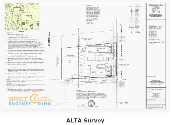
While a boundary survey, the ALTA or ACSM survey is more thorough. The National Society of Professional Surveyors, formerly known as the American Land Title Association, sets the industry’s standards.

This provides information on the extent of any easements and encroachments as well as the property’s permitted uses as determined by municipal or state law.
Topographic Survey.
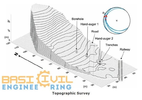
The terrain’s geographic features are a topographic survey’s primary focus. All information on elevation points, contour lines, slopes, etc., are being collected here.

The aim is to compile all information regarding the lands’ natural and anthropogenic aspects.
Construction Survey.
Construction surveys are essential whether the project is for a building, bridge, road, or highway.
This will identify all significant land surface features that can affect the building. During the surveying procedure, the surveyor will determine the spots on the property that can be used as markers to direct the construction of the new structure.
This study lays out the utility lines, substantial construction sites, street networks, their locations, and the alignment of highways, roadways, and bridges.
Construction surveys are crucial for every project since they directly impact the budget, schedule, design elements, and other factors.
Read More
-
What is the distinguishes particleboard from MDF?
-
Railway / Why Crushed Stones Are Used In the Railway Track
-
What is the Bricks & Important Tests on Brick
-
Technology for the locating underground utilities
-
Types of the Roads or Classification of Roads
-
Difference between a one-way slab and a two-way slab
-
Curing of the Concrete | Curing time And Duration | What is Curing methods
-
Differents Types of Beams in Construction
-
Construction projects using concrete: Materials, Types, and Applications
Contour Survey.
When a point on the ground is contoured, its elevation is determined and the point’s horizontal position is fixed on the contour map.

This map illustrates the valley, the gentleness of the slope or steepness of the pitch, and the hill to identify any discernible difference in elevation of the existing area.
A contour survey is conducted at the beginning of engineering projects like a canal, railroads, building, dams, and many others.
Layout & Demarcation Survey.
Measurements taken to regulate elevation, horizontal position, dimensions, and configuration before or during construction are referred to as construction layout surveys.
Survey or planned building boundary points are located on the ground through demarkation.
Site Survey.
A topography and border survey are both components of a site planning survey. This serves as both a representation of the plot land improvements and a tool for creating site plans and documents.
Location Survey.
Determining the property lines, buildings, and any other improvements (driveway, sidewalk, retaining walls, etc.) and their relationships to one another are the key objectives of the location survey.
Afterward, these data and measurements are recorded on a drawing known as a location drawing or, occasionally, a house location drawing.
Subdivision Survey.
A subdivision survey is performed when land is divided into two or more lots, either for immediate or future building development or sale.
Mining Surveys.

A mining survey is crucial for on-site mine activity. It creates a comprehensive map of the mine, updates surface layout maps to reflect new mining sites, and surveys the underground mine workings to maintain a record of the mining process.
Why Get a Land Survey?
In a real estate transaction, a land survey is not always necessary, but it can be helpful in resolving any disputes that may arise between the seller and the buyer of the properties.
Resolve Boundary Issues.
When there is disagreement over the boundaries of one person’s property, land surveys are frequently ordered to resolve boundary concerns.
That is crucial since, as a seller, every square meter counts when it comes to profiting from a home.
Pinpoint plot price and Plot Size.
The plot’s size can influence a property’s price, and this information is available from land surveys. As a result, if the action is less than what is being listed, it might be a terrific opportunity to bargain for purchasers who want to try.
It might be very advantageous for those who want to purchase real estate.
Build a New Home.
Doing a land survey is an excellent idea while building your own house. Finding locations to build the main building or choosing where to put the drainage can be helpful.
FAQs:
What is the Land Surveying?
A land survey of the construction site is necessary before anything is built in order to measure the topography factors, Angle, pinpoint the position of existing infrastructure, identify the limits of your structure, determine the slope of the ground, and many other things.


