Land Surveying
-

Method Statement for Survey Works
Method Statement for Survey Works. 1. Purpose: This Method of statement provides guidance on performing detailed site surveys of installation facilities and civil works complying with the project requirements. Technical specifications, procedural guidance, and quality control criteria are outlined for developing large-scale site plans used for engineering drawings of planned projects, or detailed as-built feature mapping of completed facilities as required. 2 Scope of Work: The works shall involve the…
Read More » -

Top 30 Questions and Answers for Interviews About Surveying
Top 30 Questions and Answers for Interviews About Surveying Are you getting ready for a job interview as a land surveyor in civil engineering? You’ve taken a step toward a career that will be rewarding. We have compiled a list of the top 105 survey questions & answers to the help you do well in the following interview. This excellent resource covers a wide range of the topics, from basic…
Read More » -

What’s the Contour Mapping?
Contour Mapping – Characteristics, Methods & Uses. Contours are the lines that connect points on the earth’s surface at the same height. A contour is a line that cuts through the ground and meets a level surface made by joining points at the same size. Contour Map. The map with the contour lines is called a “contour map.” The contour map shows how high the land features are and where…
Read More » -

Responsibilities of a Land Surveyor
Responsibilities of a Land Surveyor The Land Surveyor’s job is to take accurate measurements showing where the boundary is. Surveyors help Engineers make maps and build projects by giving them information about the unique shapes of the earth’s surface. The following are the Duties of the Land Surveyor. The Surveyors must measure the distance and angles between certain points on the surface of the earth. By traveling, you can find…
Read More » -

Five Different Types of The Chains In the Civil Engineering
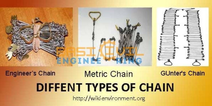
Five Different Types of The Chains In the Civil Engineering. Introduction to the Chain Surveying. The chain surveying method involves dividing the actual land areas into the little triangles and then measuring each side of the each triangle directly using a chain or tape. In surveying, there are various types of the chains used to calculate land area. Chain surveying is appropriate for small and less obstructed regions because it…
Read More » -

What is Land Surveying and its Types
10 Types of the Land Survey | What Is the Land Surveying A land survey of the construction site is necessary before anything is built in order to measure the topography factors, Angle, pinpoint the position of existing infrastructure, identify the limits of your structure, determine the slope of the ground, and many other things. What Is Land Surveying? By making observations, collecting measurements in the field, using various surveying…
Read More » -

Types of the Roads or Classification of Roads
Types of the Roads or Classification of the Roads. What is the Road? The road is a paved path, a route, or a highway that allows cars to transport people to their destinations. Roads are categorized using various criteria, which are then further subdivided into various road kinds. I briefly explain each type and term you usually hear when someone talks about roads in this post. These are the main…
Read More » -

Understanding, Components, Benefits, and Limitations of Dumpy Level Surveying
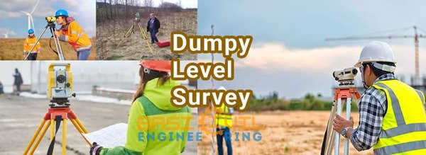
Understanding, Components, Benefits, and Limitations of Dumpy Level Surveying About Dump Level Instrument:- An optical tool for leveling and surveying tasks is the dumpy level. Included in it is a telescopic tube that is securely fastened using two collars and adjustable screws. The following is a list of the upcoming events for the year. You can move the telescope on the dumpy level around the horizontal plane. The dumpy level…
Read More »
